Quarry search with Clay
EXPERIMENTALSearch IGN aerial imagery with Clay embeddings, then compare candidate quarry sites with the ICPE registry and OpenStreetMap.
Unmatched candidates are leads for human inspection. They are not evidence of non-compliance. Nationwide coverage remains a possible extension.
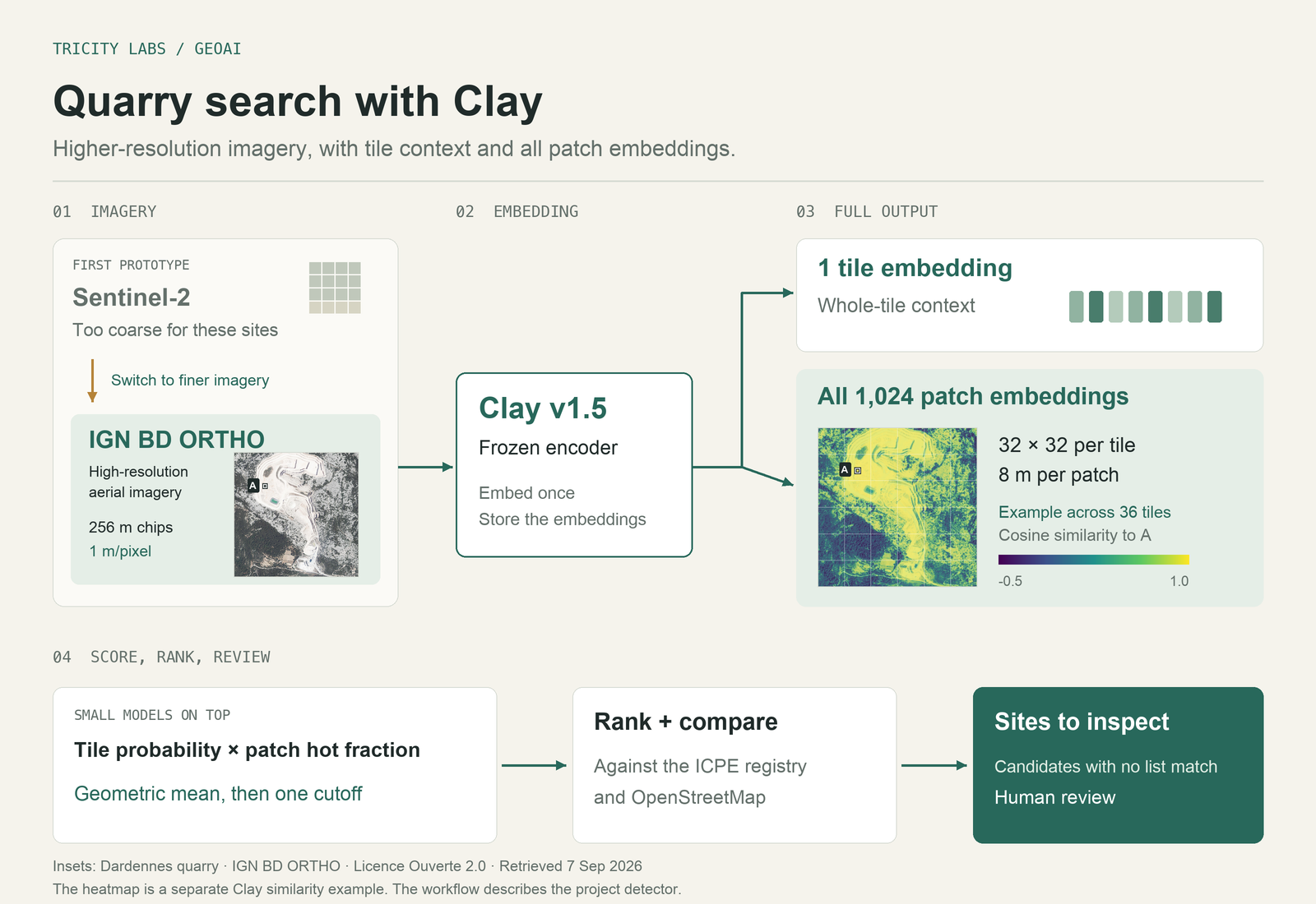
Imagery, embeddings and review
Frozen Clay v1.5 embeddings provide whole-tile context and local patch information. A small classifier combines them to rank candidate sites for inspection.
The current work covers indexed areas in PACA and Auvergne-Rhône-Alpes. The reference lists have gaps too, so a missing match needs human review.
Illustration: Dardennes quarry. IGN BD ORTHO, Licence Ouverte 2.0. Retrieved 7 September 2026. Reference mapping: © OpenStreetMap contributors.